


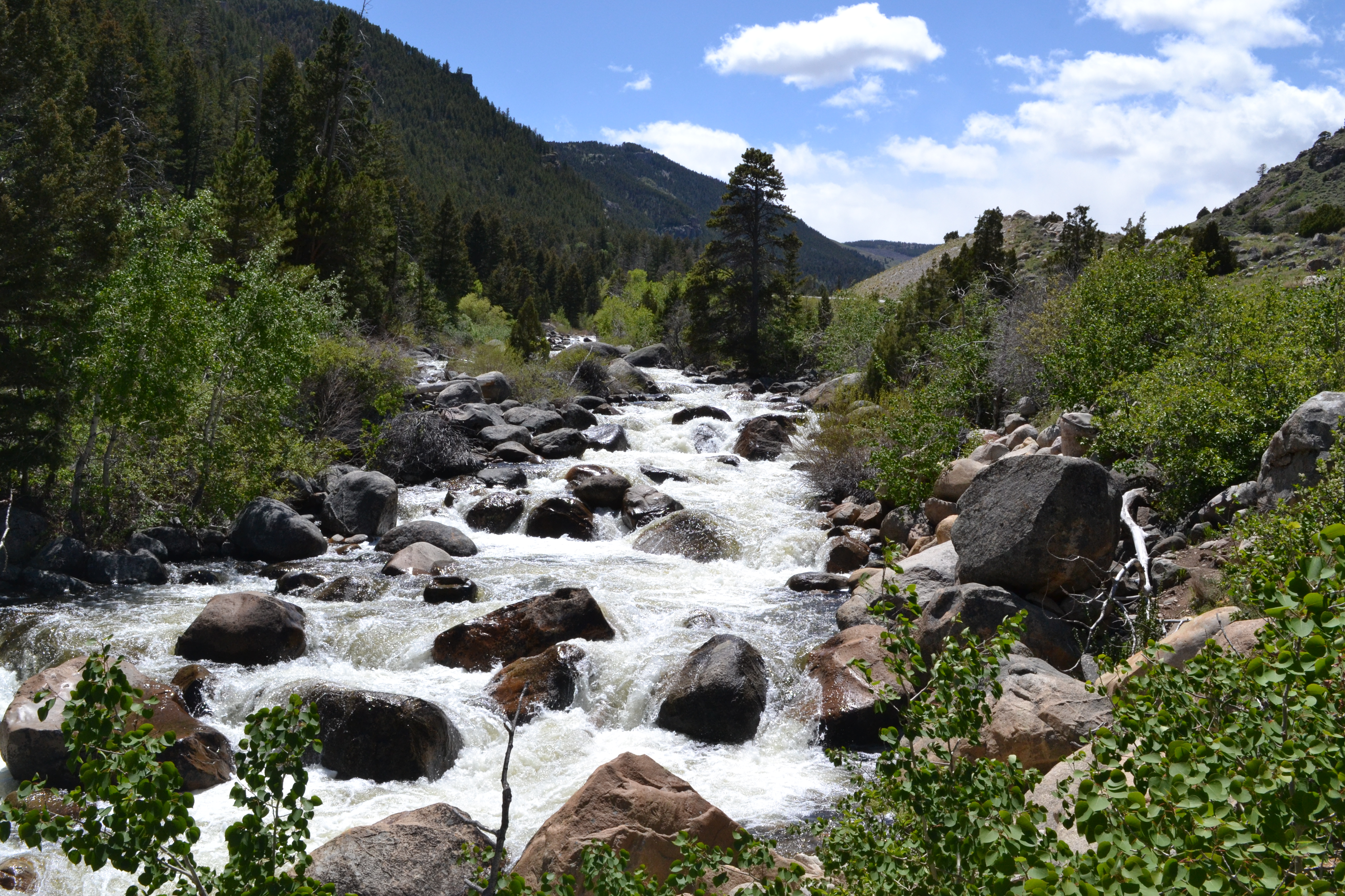
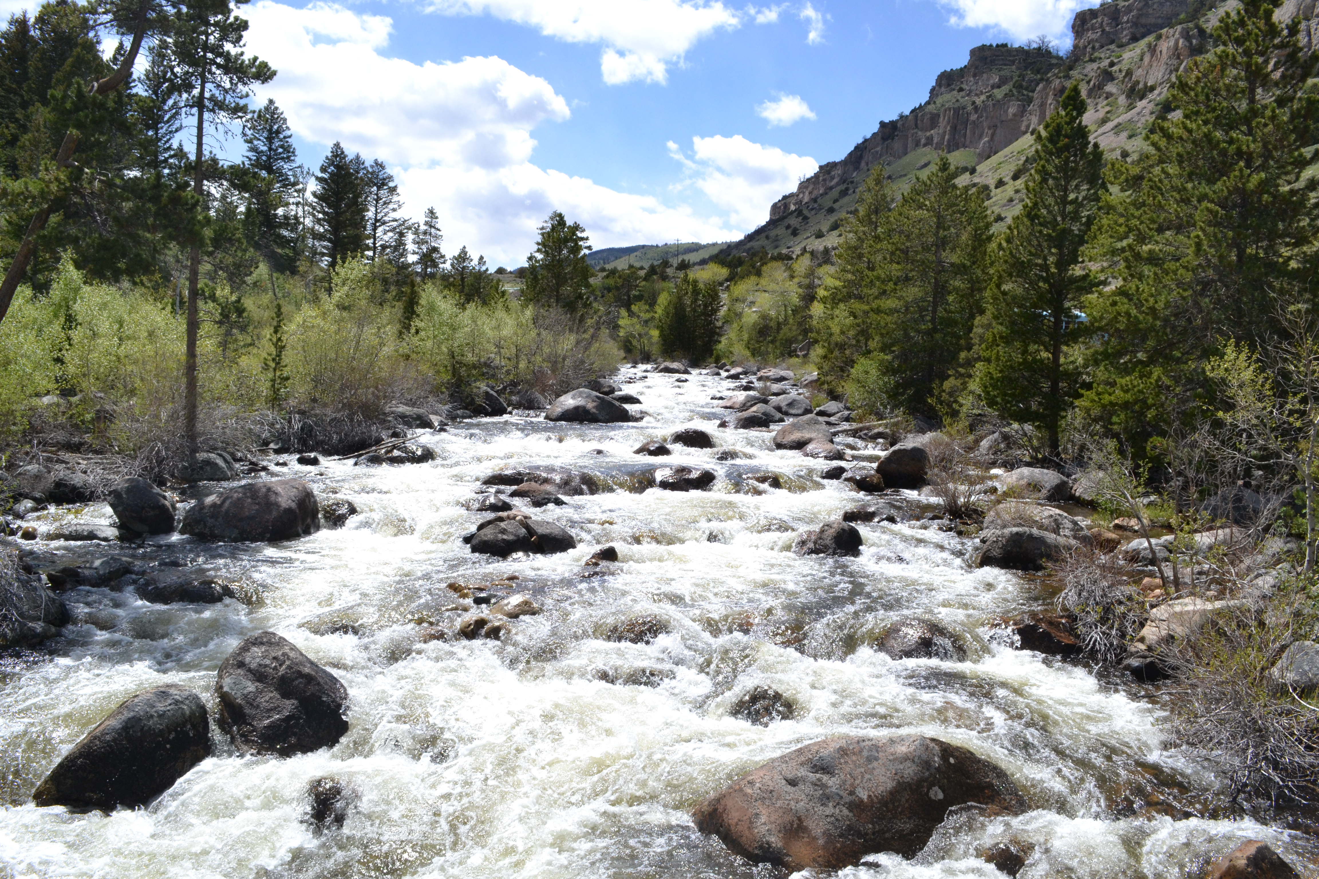
The Popo Agie River running toward the sinks
Hiking in Wyoming’s Sinks Canyons State Park is a great way to break up the long drive to Yellowstone from Denver. By about hour five on the road, I was ready to stretch my legs past getting some gas. So the sign pointing me to the park from Lander could not have come at a more opportune time.
I hopped out of the car at the visitor center and went in to pay the fee. Good news? There is none. The park is free to whoever wishes to visit. There’s a charge if you want to camp, but nothing just to stop off and hit a trail or two. And there are a few good choices, some of which connect to others, so it’s all a matter of desire.
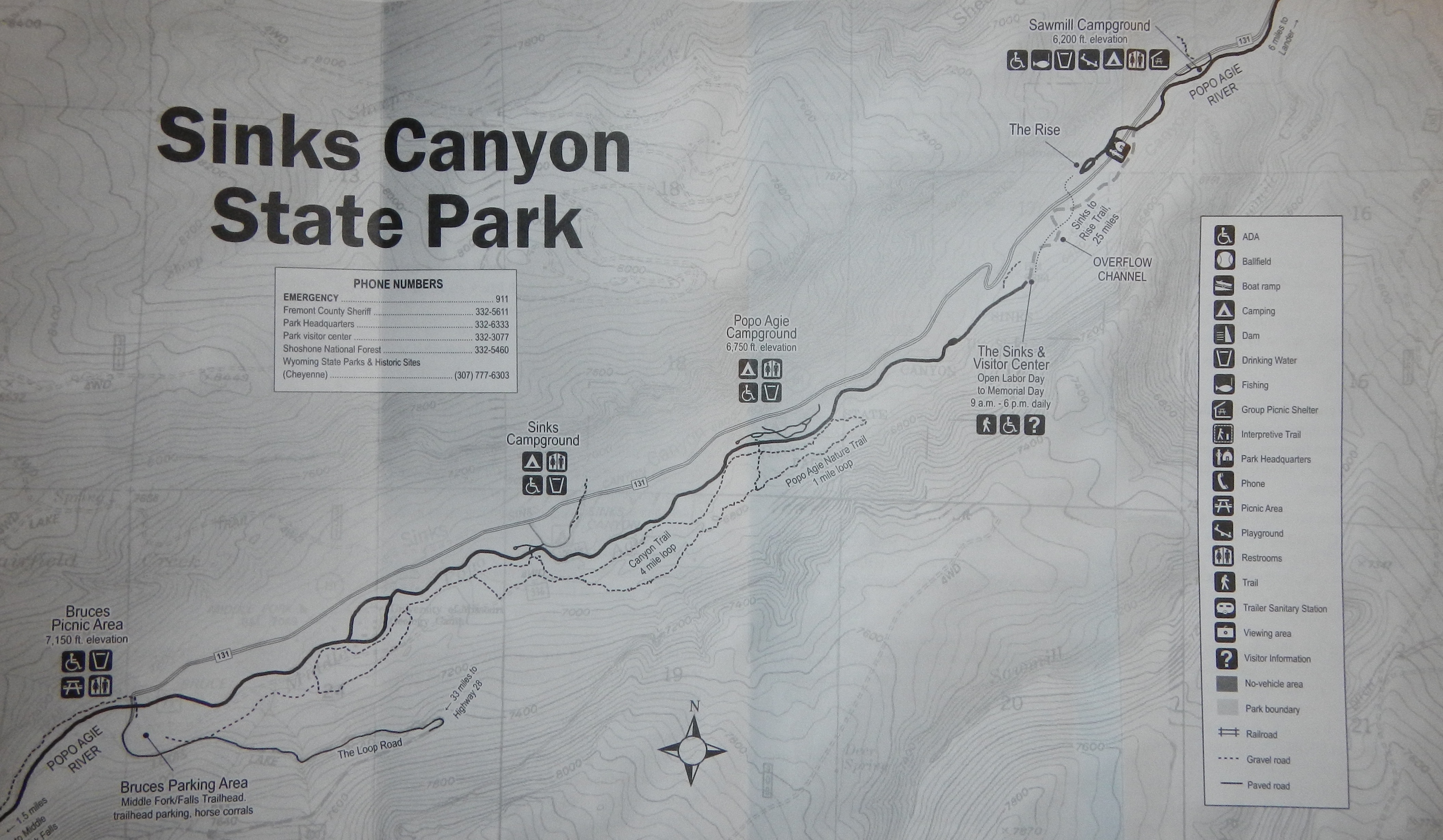
Wyoming’s Sinks Canyon State Park brochure map
Wyoming State Highway 131 slices through Sinks Canyon and the state park from Lander, Wyoming. I pulled off it to the visitor center, but pick an exit and start a hike at any one of the trail heads. See the map above for more on each trail.
Since I was already at the visitor center, and it’s here where the famous sinks are located, I chose this spot to do my short jaunt. Before I get into that, though, I’m sure you’re wondering what exactly the sinks may be. Well, it’s the spot in the canyon where the middle fork of the Popo Agie River sinks down underground.
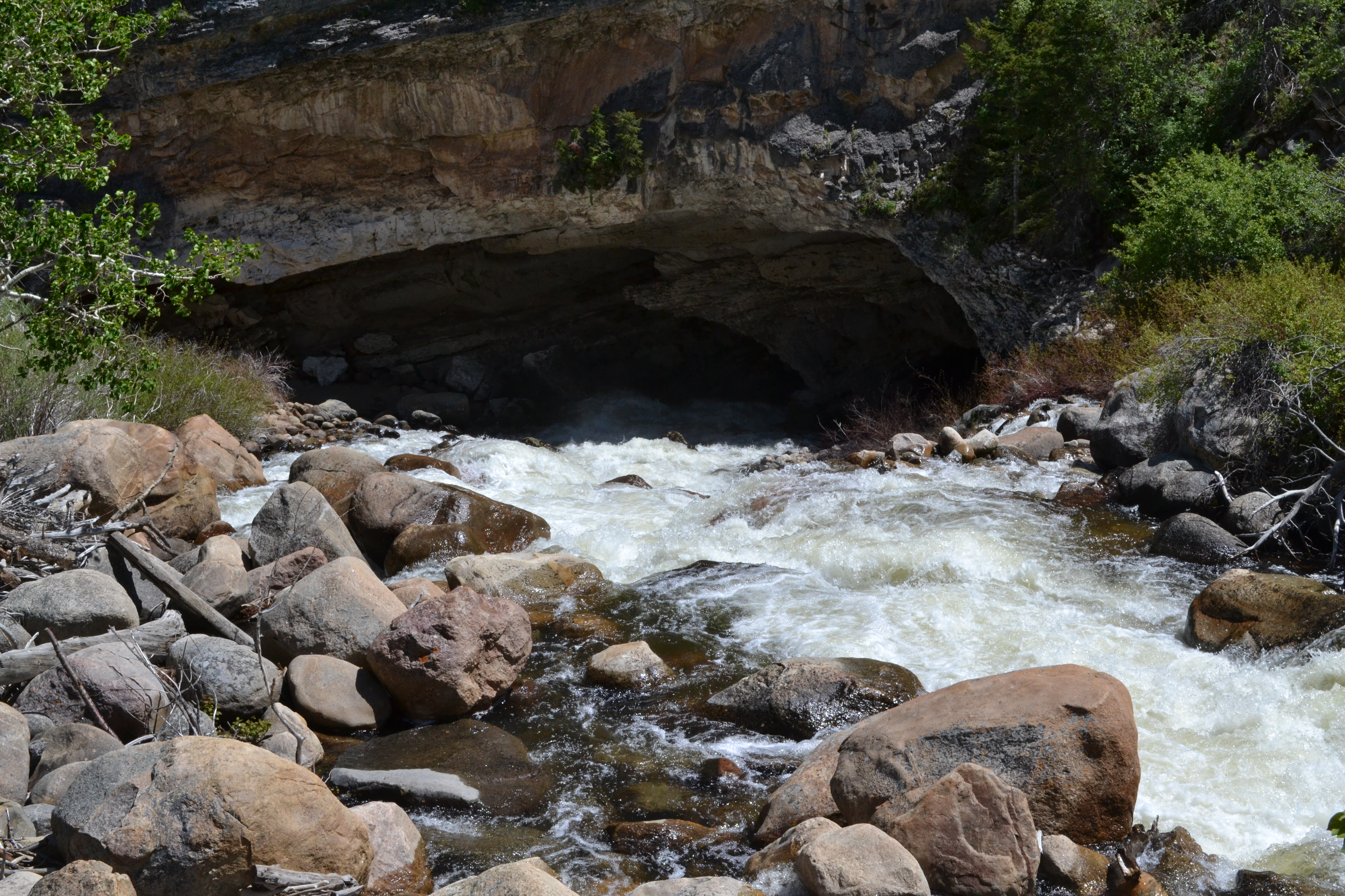
The Popo Agie disappears underground
The water goes down into a cavern that has barely been explored, and then reemerges on what is now the other side of the road. The trail between the two spots is the same length of the river’s disappearance – a quarter of a mile one way. It’s relatively easy, with only a slight elevation gain for the hike back to the visitor center.
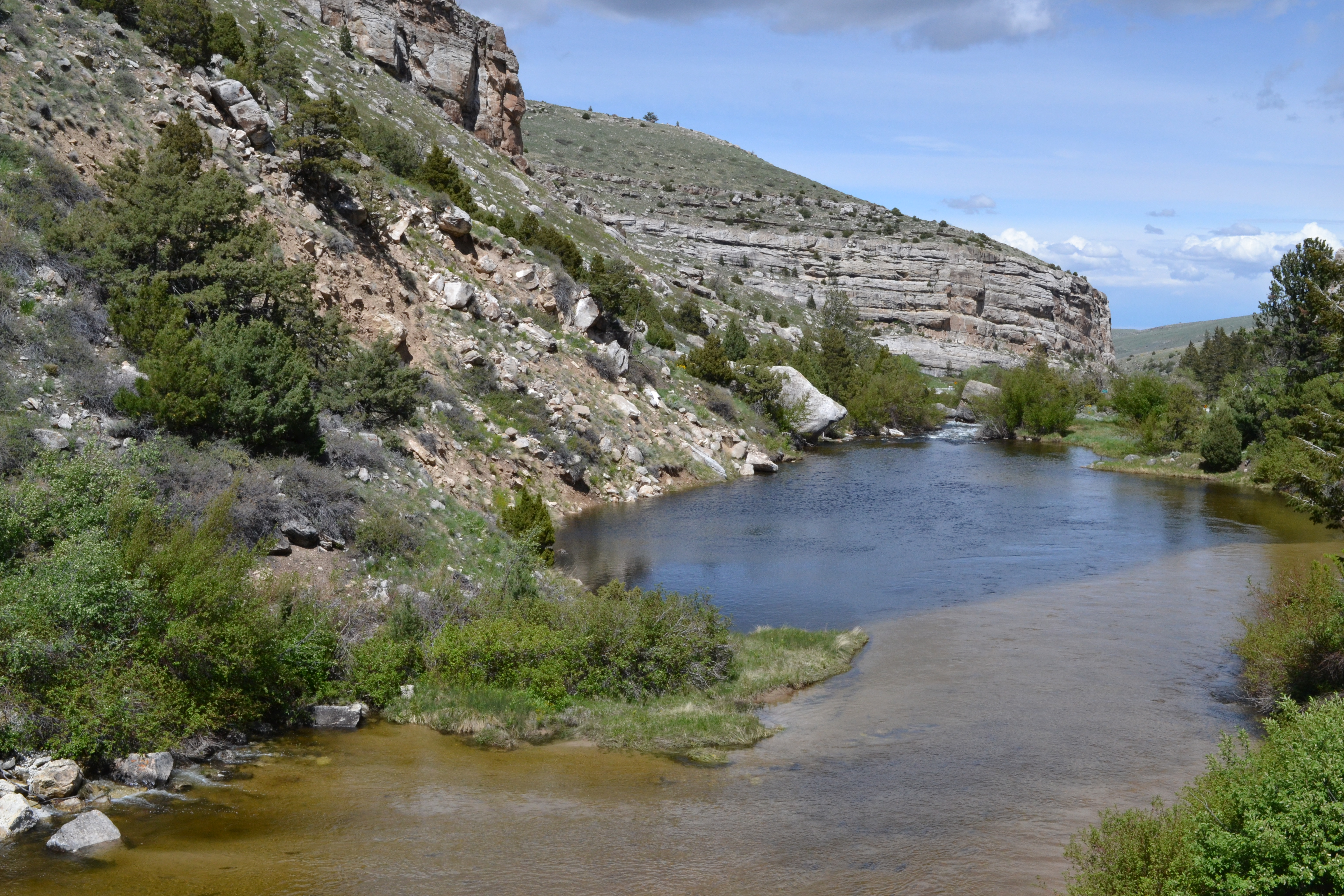
The Popo Agie reappears a quarter of a mile downriver
If a longer walk is of interest, there are plenty of trails in the park. All of them are of varying lengths, and some of them can be combined to form a much longer chain of trails. I was only looking for a leg-stretcher during my drive, so, after my short walk and a few photos taken at some other spots along the Popo Agie, I hopped back in the car and continued on my long way to northwestern Wyoming and my final destination – Yellowstone.
Stopping to check out the Popo Agie upriver

Leave a comment